
EWS Parity Through Four Startups
The Solutions
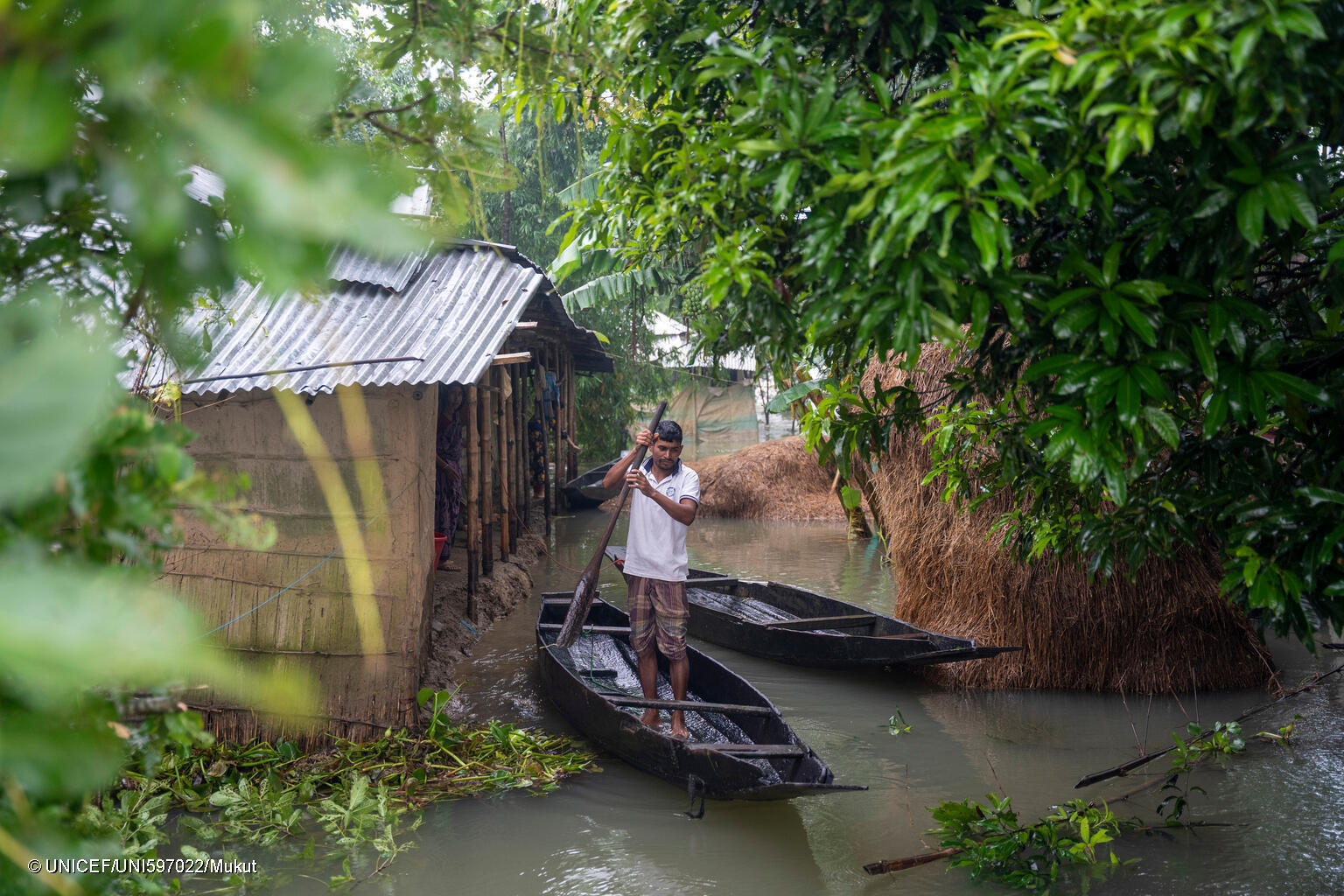
With UNICEF support, Similie’sresulting product is a near-end-to-end EWS combining IoT monitoring, risk forecasting, and community alerts. Since 2021, Similie has issued eight flood alerts to government and stakeholders, helping protect 300,000 people; and since partnering with the Venture Fund, it has delivered over 529K warning emails to decision-makers and stakeholders for emergency response coordination.
Equinoct created a community-sourced flood forecasting system using custom rain gauges, a mobile app, and a network of local contributors. At the core is a web-based AI/ML data dashboard that supports decision-makers with real-time risk visualization. During their time with the Fund, Equinoct developed and tested these components and launched the dashboard at the Ernakulam District Disaster Management Authority.
Map Action developed a mobile app that turns citizen reports into real-time environmental insights. These insights are further enriched with satellite imagery and open-source maps, transforming community inputs into geo-analytical intelligence that enables municipalities and decision-makers to respond quickly and allocate resources effectively.
Map & Rank built an AI-powered platform and mobile app that provides forecasts for riverine flooding by integrating diverse data sources. Piloted in Mayo Danay, a region notorious for riverine flooding, the platform offers five-day lead-time flood forecasts with about 70% accuracy.
Cross-cohort Insights Aligned with Global Best Practices
The experiences of these startups have surfaced the following valuable insights, some of which already echo principles highlighted by international climate authorities such as the United Nations Office for Disaster Risk Reduction (UNDRR) and the United Nations Framework Convention on Climate Change (UNFCCC) as essential for next-generation early warning systems.
Warnings need to shift from hazards-based to impact-based
Effective and actionable early warning must signal not just what the weather will be, but what the weather will do—to populations, livelihoods, infrastructure.
Forecasting accuracy improves dramatically when global forecasts are augmented with hyperlocal data
Global and regional forecasting models and remote sensing—while useful for large-scale climate monitoring—often lack the resolution to capture microclimates, flash floods, or variations in rainfall and river basins. A 2024 EWS status report by UNDRR and WMO states that stronger observational networks and hyperlocal data streams are critical to ensure that warnings are accurate, trusted, and timely.
Communities must be positioned as actors in their own resilience, not passive recipients of warnings
Close to a third of disaster-affected people between 2018 and 2023 received no warning, and close to 50% of people say they cannot protect themselves and their families in a disaster. UNDRR and UNFCC explicitly affirm that communities—including Indigenous peoples, local stakeholders, marginalized groups, and youth—are not passive recipients, but rather essential agents in building resilience.
Funding pathways need to be rethought: cost-effective doesn’t automatically mean affordable, accessible, or sustainable in developing contexts
EWS deliver a 10× return on investment and investing USD 800M in them in developing economies would avert losses of USD 3 billion to USD 16 billion a year. But cost-effective doesn’t necessarily mean affordable. Upfront costs and maintenance in developing contexts remain high and sustainable finance seems elusive. 54% of EWS funding from multilateral development banks and climate funds in national projects are concentrated in only five countries. This signals the need for innovative financing models—including blended finance, subscription-based services, risk-sharing models (e..g, parametric insurance), and community-owned systems to not only expand EWS reach but to also ensure long-term functionality and scale especially in developing markets.
Open source builds legitimacy in contexts where operational budgets are limited. “Open-source platforms, mobile-based alerts and simplified digital tools are examples of solutions that can help extend access to high-tech approaches while reducing financial burdens on resource-limited communities,” says a UNDRR report on use of tech for DRR. Furthermore, open source more greatly enables local adaptation and bolsters customer confidence among governments that, especially amid limited fiscal space, are skeptical of vendor lock-in.
Early-stage startups need to diversify clientele while awaiting longer-term government engagement. Government engagement remains essential for scale but requires patience. There is an increasing need to explore alternative client bases—such as SMEs, cooperatives, and communities—to deploy more quickly and remain financially solvent.
Iteration is the lifeblood not only of learning but of early-stage survival and trust-building. Climate authorities have a long-held belief that “climate-resilient pathways are iterative, managing change in complex systems… revising risk-reduction responses through continuous learning,” an adage that resonates especially with early-stage EWS tech development, which must demonstrate efficacy and win market uptake while operating under tight budgets.
How these insights surfaced in the cohort’s investment experience
Shift from hazards-based to impact-based
Similie integrates its ML model with demographic and GIS data to provide not only forecasted alerts of impending floods but also insights into the expected impact on specific communities for dutybearers to understand the level of risk facing lives and livelihoods.
Equinoct expanded its flood forecasting model into three productized tools: InSight (real-time climate and flood monitoring); ForeSight (scenario projections with lead times and accuracy metrics); and SeaSight (tidal and sea level rise modeling). Together, these tools equip administrators and DRR managers with multiple scenarios and critical decision-support that allow for proactive planning.
The geotagged photos uploaded via mobile app to Map Action’s database help predict environmental issues, identify surrounding points of interest, assess the impact on those points of interest, and suggest potential solutions. For example, a photo showing debris obstructing a waterway may signal an impending flood risk. Data is sent to a dashboard that provides the municipality with a comprehensive analysis, enabling them to take preemptive action.
Map & Rank’s use of generative AI lets users query visualized map data for tailored insights. The platform continually evolves based on community feedback, not only providing forecasts but also focusing on how weather events could impact their specific livelihoods. "People wanted to know how these floods would affect their farms," states CEO Sikem Bryce.
It’s worth noting that while sector-specific insights (such as those for farming or livelihoods) make forecasts more actionable for communities, climate adaptation tools themselves must be multisectoral by design. Hazards are sector-agnostic, but impact sweeps across sectors—agriculture to health, education, water, and infrastructure.
A 2024 policy brief by the UNFCC Technology Executive Committee explicitly stresses that climate adaptation tools must remain multisectoral, integrated, and system-wide to strengthen resilience and avoid fragmented or siloed responses—essentially to balance a multisectoral system with tailored sector outputs.
The Need for Hyperlocal Data
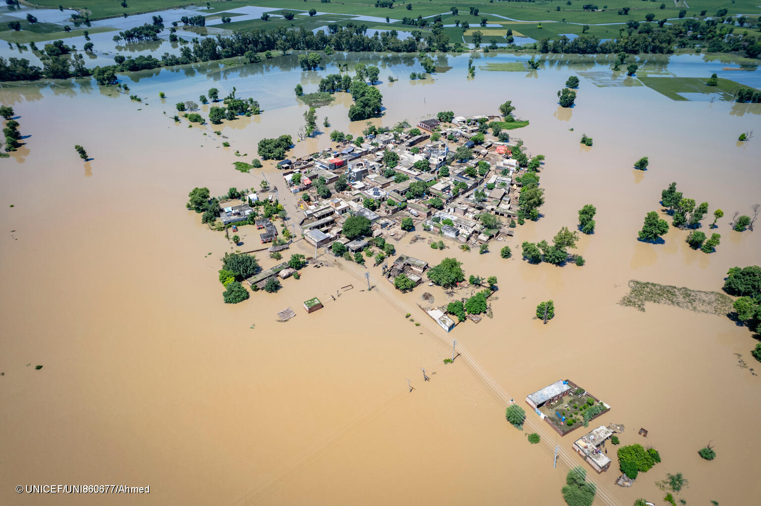
Similie’s solution is high-frequency and ground-based, relying on minute-by-minute IoT sensor data, analyzed against adjustable thresholds set on Similie’s field-collected data (e.g. rainfall mm, soil moisture %) or on third-party datasets (e.g., global forecasting models).
Equinoct’s community monitoring network with 100 custom-designed rain gauges capable of capturing extreme rainfall that standard gauges miss, fills a field-level observational gap in communities often overlooked by conventional forecasting systems.
Map & Rank combines data across multiple scales—ground-based gauges, stream flow, fieldwork, citizen reports, historical flood records, and spaceborne data—to create a granular, multi-layered picture of local risk.
Communities as actors in their own resilience
For Equinoct, citizen science (i.e., citizens as knowledge creators) is at the heart of its model. Its Gather Network is comprised of different community groups (from cooperatives to intergovernmental agencies), including women, youth, and children. 38% of the network are students. Citizens input rainfall, river water levels, groundwater levels, and tidal levels data through Equinoct’s app and rain gauge. This is then integrated into the web dashboard, which users can access climate parameters, forecasts, and multiple impact scenarios.
Map Action’s platform is built on a citizen reporting loop that’s participatory rather than one-directional. Communities generate the data (photos, videos, geotagged notes) and are able to receive feedback from authorities through the app.
Map & Rank’s platform provides a shared data infrastructure for collaboration with frontline stakeholders. During field research, as a co-designing exercise, the company even developed games to involve communities and improve collective understanding of climate risks and early warning alerts. The platform integrates community reports to monitor stream changes and flood impacts, and has seen strong adoption particularly in agriculture.
Rethinking Funding Pathways for EWS
Though the startups are considerably still early stage and continue to refine their business models, they demonstrate a clear orientation toward alternative models suited to developing contexts, like free citizen use with paid institutional subscriptions or B2B tailored risk analytics.
Among the cohort, Similie has undergone the most significant business model transformations within a year—emerging with a lessons-driven and bold yet thoughtful strategy for growth.
They transitioned from a traditional solutions provider to an open-source-first approach, a shift that encouraged developer contributions, reducing dependency on external sales and costly marketing. It also provided a potential revenue-generating API for organizations and tinkerers seeking real-time data outputs.
Looking ahead, Similie aims to develop tailored EWS products for diverse institutional needs, with revenue from hardware integration, platform subscriptions, consultancy, and certification/training for its open-source tools. The company is pursuing collaboration with regional governments and private firms in insurance, construction, and utilities.
To stay competitive with larger traditional big players, Similie has also shifted its model to focus on “selling action”—offering emergency response capabilities rather than simply hardware or software.
Adam Smith, CTO, explains, “Stakeholders try to come up with budgets of $100,000 to $200,000 to deploy two or three stations; we're saying we'll find $100,000 and deploy 40 stations. And they would just need to pay a monthly fee per person at a price point low enough for them to immediately recognize the value.”
The concept has sparked excitement and interest but remains largely untested, with uptake yet to be seen.
The Value of Open Source
Similie’s IoT line is fully open source, with hardware schematics on GitHub, enabling partners to either buy directly from the company or build their own systems—an approach that amplifies reach without costly marketing campaigns. This strategy has already drawn contributions from external developers, such as machine learning students in Australia, who enhanced Similie’s forecasting models. For Equinoct, developing their platform as open source has not only made their community-led system more transparent but also invited collaboration from international experts, including volunteers from Google.
Diversifying Clientele
Map Action reflected that earlier outreach to government during the process of developing the solution would have facilitated adoption and responsiveness. That said, all four startups have been able to successfully engage with and demonstrate their value to government. Equinoct launched their dashboard with local DRR authorities, and Map Action’s sustained engagement eventually yielded a national pilot partnership with the government agency for pollution and WASH.
Iterative as Key to Survival
Similie stressed survival through “hundreds of hardware iterations, millions of lines of code.” Map Action shared the importance of starting small. “It’s not necessary to build the biggest or perfect platform right away,” says Map Action CEO and Founder Boubacar Keita, “Prove your value first, build institutional trust early.”
How Context Shaped Different Pain Points
In Timor-Leste, post-conflict fragility and limited fiscal space defined the path for Similie. Standard WML weather stations in developed countries cost around $50,000, prompting Similie to build IoT-based devices at a fraction of the cost. “Approximately $3,500 per system with deployment,” CTO Adam Smith says, “about 51 cents per inhabitant.”
In two Kerala flood-prone basins, variability was extreme. “Annual rainfall average from 3,500 to 8,000 millimeters, and in some local areas, exceeding 10,000 millimeters,” shares Equinoct CEO Dr. CG Madhusoodhanan. “There is huge variability in rainfall and floods in these areas, and the hydrology of such humid tropical regions is largely unknown to the scientific community.” Existing gauges under-reported rainfall, so Equinoct developed its “Gather Gauge” and mobilized a network of 100 community monitors.
In Mali, the lack of reliable government monitoring meant citizens had to fill the gap. Map Action’s mobile app turns a photo of debris blocking a waterway into AI-driven insights for municipalities. Their biggest challenge was time: “Working with governments requires significant time, effort, and patience.”
In northern Cameroon, data scarcity was acute. With only two rain gauge measurement stations covering the entire Mayo Danay region and civil conflict leaving decades of hydrological records incomplete, creating major training data gaps. Map & Rank turned to drones, spaceborne data, and citizen inputs.

While the four startups demonstrate how frontier tech can extend EWS reach by filling data gaps, localizing forecasts, and placing communities at the center of resilience-building, their experiences highlight that technology doesn't work in a vacuum. Sustainable EWS tech requires integration into governance systems, financing models that treat warnings as public goods, and multisectoral coordination to ensure meaningful impact especially at the last mile. Achieving true parity in early warning access will depend not just on innovative tools, but on the political will, institutional capacity, and equitable financing needed to embed these solutions into national systems.
Stories by this author
How UNICEF Yemen Transformed Cash Transfer Programming From Reactive to Real-time Accountability
Read StoryRelated Stories


