Portfolio News

Turning Local Data into Climate Action: How Map & Rank Is Empowering Communities in Cameroon

Map&Rank Drones Cameroon
Jun 06 , 2025
Man rides bicycle in flooded area of Mayo Danay in northern Cameroon
On this page

Drones

Map&Rank

Cameroon
Amount invested $80,000 USD Funding Status active early period Founded in 2020 by Sikem Brice

In the flood-prone Sahel region of Northern Cameroon, where climate change is a daily reality, a local startup is helping communities turn data into resilience. Map & Rank, a recent graduate of the UNICEF Venture Fund’s Climate Action Cohort, is building a location-based platform that helps disaster-sensitive communities anticipate and respond to climate risks—starting with floods and droughts. 

Map & Rank presents solution before a crowd in Mayo Danay, Cameroon

From Crisis to Innovation

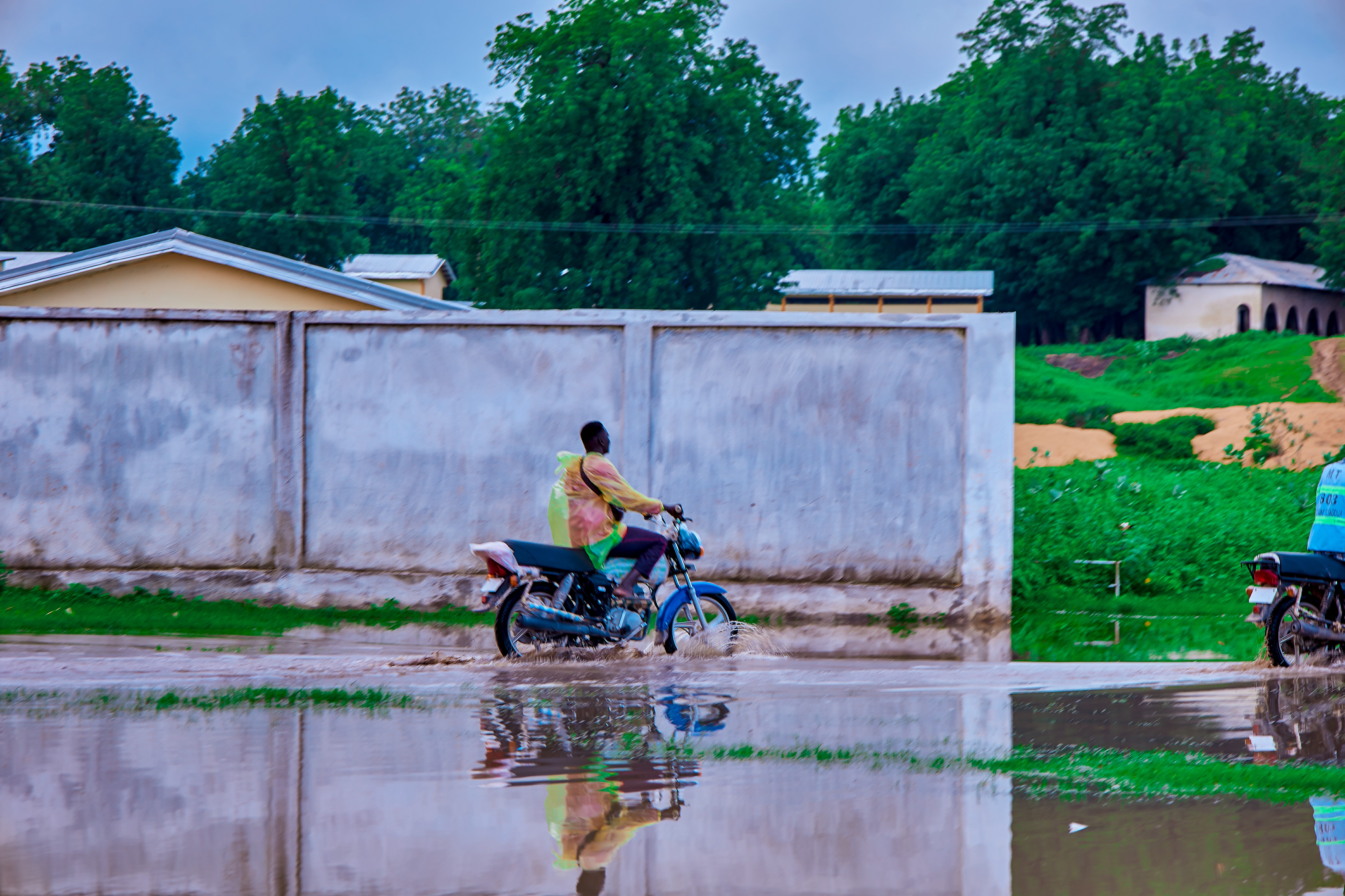
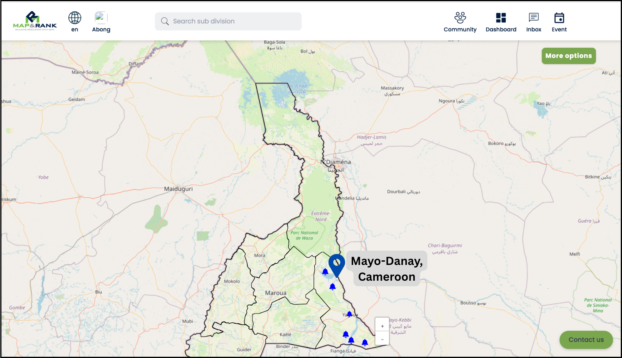
In August 2024, Map & Rank launched the first version of its platform, Residat, in Mayo-Danay—a region hit by devastating floods that displaced over 200,000 people.  

Mayo Danay, Cameroon is located in the northern part of Cameroon.


“By launching in Mayo-Danay, we were addressing an urgent need for localized, data-driven tools,” said Sikem Brice Nyuykonghi, co-founder of Map & Rank. “We wanted to build a system that not only predicts climate risks but helps communities make sense of that information in ways that are useful to them.” 

Within eight months, Residat had registered over 5,000 freemium users, representing more than 4,000 households and an estimated 16,000 people indirectly reached. The team also onboarded seven local councils, bridging the gap between community voices and institutional response. 

User feedback on the Residat platform

From Prototype to Impact

What began as a machine learning model to predict floods and droughts has evolved into a broader tool for climate resilience. By monitoring river reservoir levels, the system aims to forecast hydrological risks. 

User engagement is consistent, with agriculture-related content making up 50% of platform activity—underscoring its relevance for farmers. 

Mayo Danay Agriculture Posts


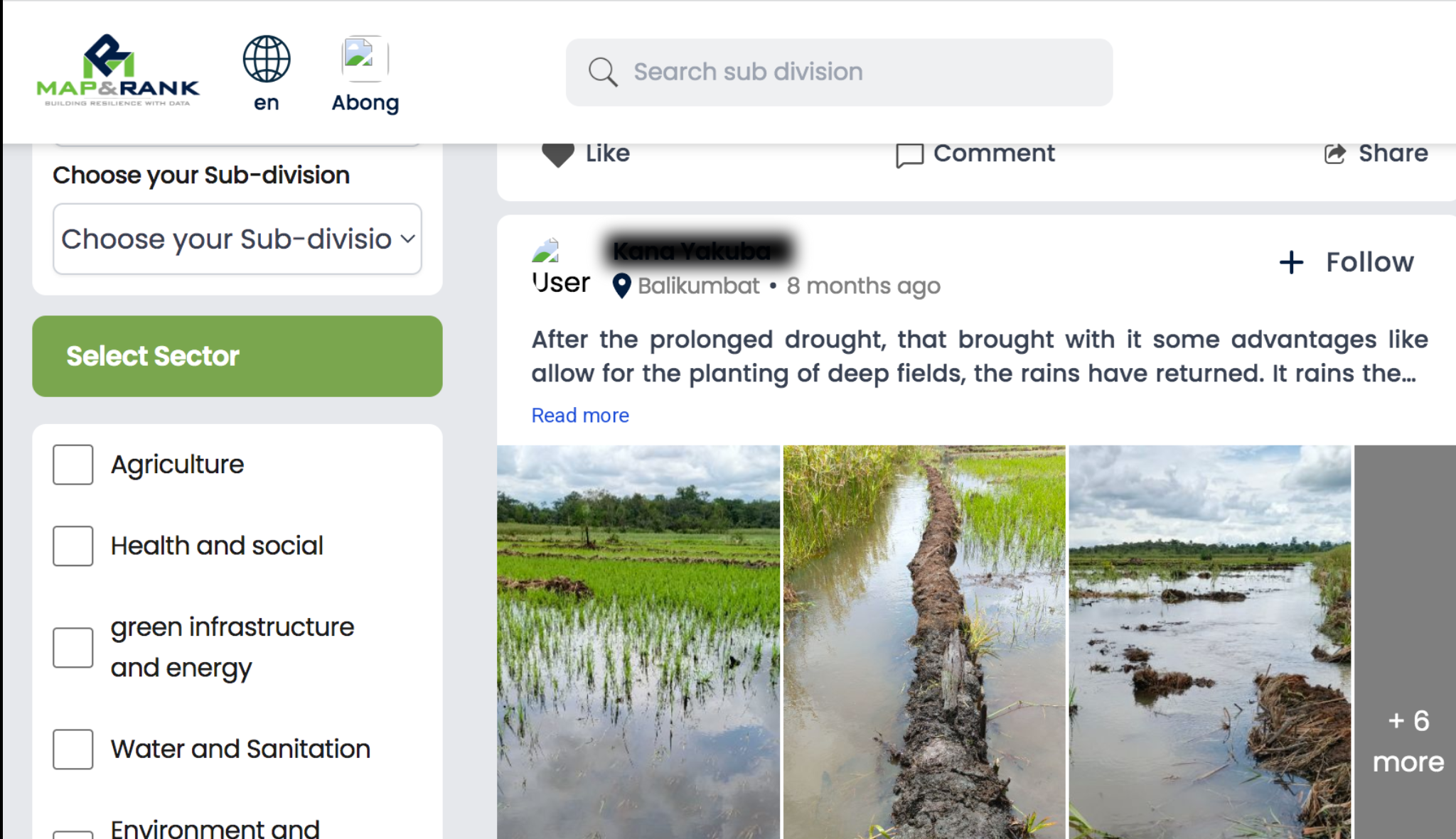
One user shared after the October 2024 floods:

 I visit Residat daily for health and safety advice during the flood. I’m also glad I can connect with others in my community going through the same thing.
Residat user following the October 2024 floods in Mayo-Danay

This feedback helped shape Residat into more than just a warning system—it became a shared space for local support and learning. 

Expanding Features and Shifting Models

What began as an early warning tool has since evolved into plans for a broader climate resilience hub. Future platform developments will support post-hazard response planning, including health and safety updates, access to aid services, and farm recovery support. 

“We noticed a significant uptick in user participation after floods, especially from households looking for post-disaster information,” said Sikem. 

On the business side, Map & Rank is shifting from a government-centric model to a more agile B2B approach. They are actively engaging farm input suppliers, microfinance services, and crop insurance providers to join the platform—offering tailored analytics and risk data. 

The team projects a 40% reduction in economic losses for registered users in future flood cycles and aims to preserve 300,000 hectares of floodplain by promoting resilient crops like cassava and cashew. 

User comments on agriculture loss due to flooding in Mayo-Danay, Cameroon
Man walks in flood water in Mayo-Danay

Open Source, Frontier Tech, and the Road Ahead

Map & Rank has embraced open source to accelerate development. They’ve established CI/CD pipelines, published developer documentation, and opened their GitHub for public contribution. 

“Open source gave us structure and access to external expertise,” said Sikem. “Balancing performance and compatibility—especially with our mapping tools—was tough, but we’ve made steady progress.” 

Despite infrastructure gaps, their AI models continue to scale, supported by community-validated data and growing technical capability. 

Looking Forward

Map & Rank’s ambitions stretch beyond early warnings. They are now exploring predictive analytics for crop yields, aiming to help farmers adapt planting strategies based on forecasted climate risks. 

“Our solution can equally be leveraged to measure and predict crop yield based on climate risks forecast and suggest optimization options for farmers in vulnerable communities,” the team shared. 

The team’s mission is rooted in community resilience. From day one, they’ve focused on building trust, enabling action, and closing the loop between local insight and institutional response. 

A Year of Growth, Mentorship, and Momentum

Map & Rank’s time with the UNICEF Venture Fund has been transformative. Beyond the financial investment, the team credits the program’s mentorship, technical guidance, and global exposure as key accelerators of their progress. 

 The mentorships, networks, and exposure we received gave us the opportunity to rapidly build, test, and deploy our solution—something that would not have been possible without the Venture Fund.
Sikem Brice, CEO of Map & Rank

As they prepare to scale across Cameroon and into the Sahel, Map & Rank carries forward a sharpened vision, a stronger product, and a deeper commitment to community resilience.  

The journey is just beginning—but the foundation is solid. 

Map & Rank began its journey with UNICEF Venture Fund in November 2023 and graduated in March 2025. Read more about their journey here

To contact the team, visit their website or email [email protected]

Share this story